

The Horizon of Accountability
For SBTi FLAG committed companies, the Land Sector and Removals Standard (LSRS) is a new benchmark for the agricultural sector on climate reporting. CarbonSpace atmospheric dMRV and data platform enables food and beverage companies to meet FLAG and LSRS reporting with scientific rigor, at scale.
The Challenge
Food and beverage companies have committed to SBTi FLAG targets. Land-based emissions, removals and specific requirements for monitoring remain core challenges.
Traditional inventory methods for land based emissions and carbon removals monitoring are slow, expensive, and often inaccurate.
The newly published LSRS demands granular traceability and monitoring and reporting.
Traditional inventory methods for land based emissions and carbon removals monitoring are slow, expensive, and often inaccurate.
The newly published LSRS demands granular traceability and monitoring and reporting.

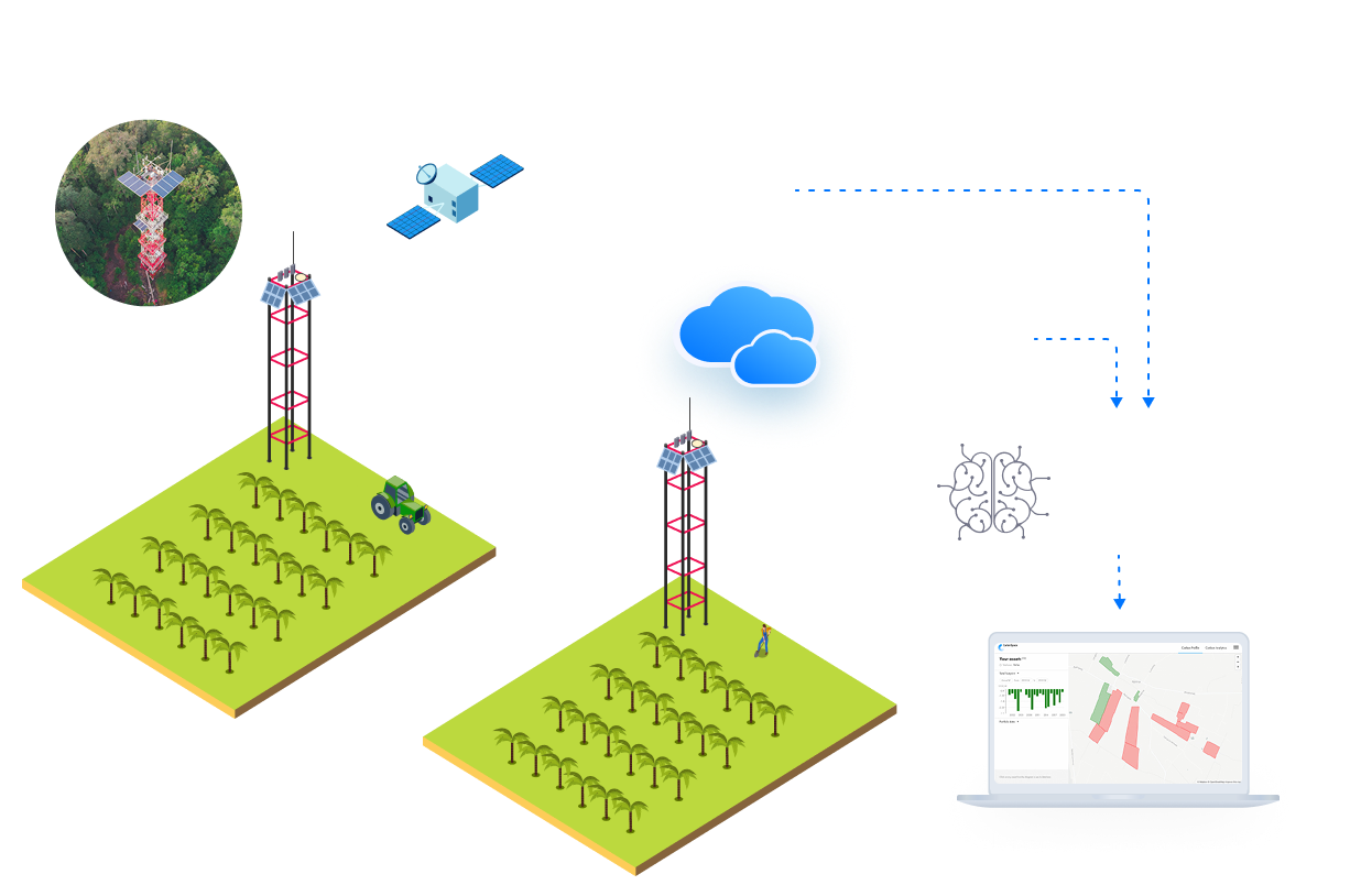
Atmospheric MRV delivers primary data driven Net Ecosystem Exchange monitoring of any landscape and delivers the input for LSRS aligned reporting.
We measure the net balance of carbon moving between the land and the atmosphere.
Our Digital MRV platform captures this NEE across millions of hectares using a unique combination of CO2 flux data, meteorological, and satellite-based AI, giving you a real-time pulse of the entire land of your raw materials supply, almost in real time.
Built for the Land Sector Removal Standard
compliant reporting
compliant reporting
- TraceabilityMap your specific sourcing regions to actual carbon flux.
- Removals vs. EmissionsLSRS requires clear separation. CarbonSpace’s NEE approach distinguishes between carbon stored and carbon lost automatically on any plot of land.
- Carbon poolsNet Ecosystem Exchange covers all 5 land based carbon pools.
- Audit-Ready Digital TrailMove from "estimated averages" to "measured realities" that satisfy third-party verifiers.
We solve your specific FLAG and LSRS challenges
Scope 3 Decarbonization
We are a leading firm in providing quality and value to our customers. We like what we do.
Supplier Engagement
Provide your growers with the data they need to improve without "boots on the ground" costs.
Investment De-risking
Quantify the carbon ROI of your sustainability initiatives.
You want MRV that’s scalable, validated, and cost-effective
That’s what we’ve built.
By combining satellite imagery and meteorological data with a globally distributed network of eddy covariance ground stations, CarbonSpace provides field-level carbon footprint estimates remotely for nearly any area and ecosystem on the globe.
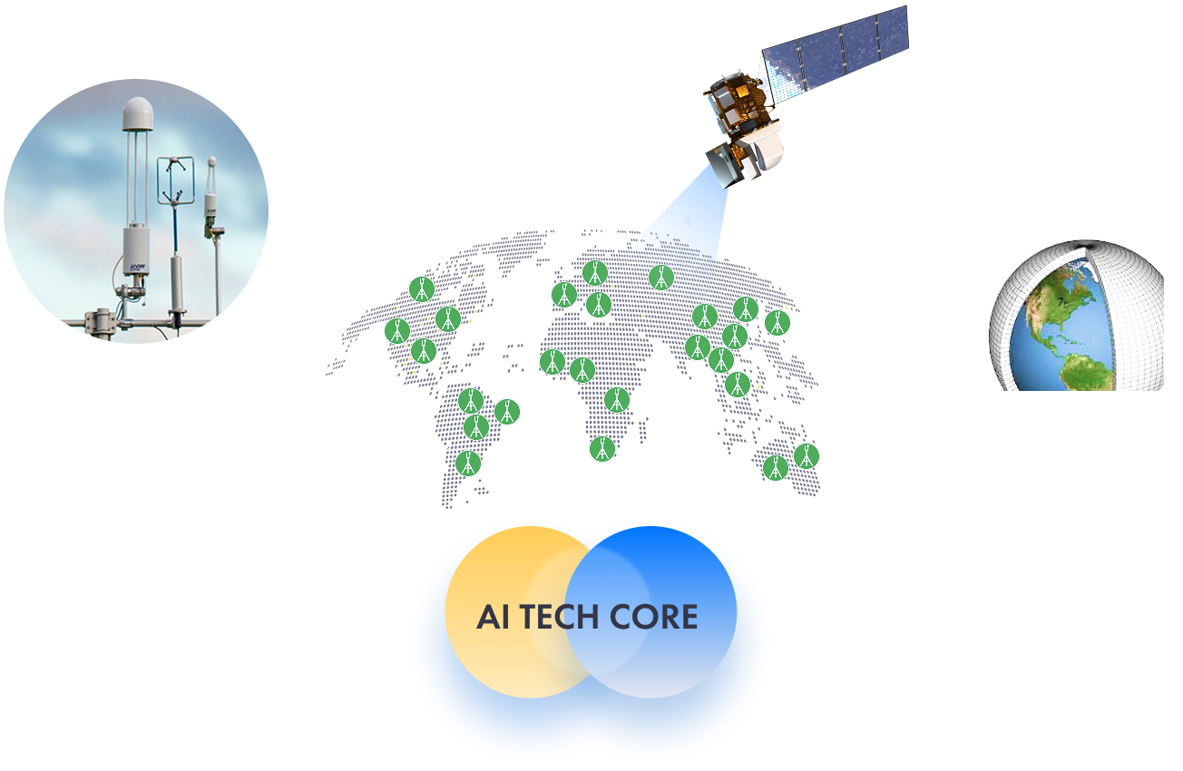
CarbonSpace uses revolutionary machine learning algorithms that estimate carbon emissions and sequestration directly at the entire ecosystem level.
This approach is globally scalable and provides decades of historical data.
How we deliver value to clients
- OnboardingWe identify your specific LSRS measurement and reporting challenges and map your desired land use carbon footprint.01
- MeasureOur direct measurements combined satellite and AI driven models generate NEEs for any land area requested by the client02
- AnalyzeMeasurements of land use carbon footprint are compared against benchmarks and undergo quality assurance.03
- Create audit-ready dataConvert data into a LSRS and FLAG reporting aligned frameworks.04
- Client reportingExport reporting data into company report for SBTi FLAG and sustainability disclosure.05
Trusted by leaders in the digital MRV space and aligned with the Greenhouse Gas Protocol's latest guidance.


Lead the Transition
Your FLAG targets are approaching. We can be your partner to provide a scalable, and cost-efficient approach for LSRS complaint reporting.
Join the pioneers using NEE to drive the transition to a Net Zero food system.
Join the pioneers using NEE to drive the transition to a Net Zero food system.